


The Baltic Tour 2012 to Vaasa and Haparanda
This summer SY Isabell sailed North. We made it all the way around the Gulf of Bothnia. Follow us in the table below.
Second part
Back to PART 1| Anchorage (date) | Position lat-long at start of day | Distance sailed daytrip(cumulative nM) | Description |
|---|---|---|---|
| Trysunda fishing village (15 July) | 63°08.2′N 018°47.9′E | 58.0 (889.0) | Nice! Full in harbour, we anchor in the middle of the village. |
| Mjältön, femoringen Baggeviken (16 July) | Norra Aspviken too shallow to go ashore. We walked up the trail to the highest island hilltop in Sweden (363m a s l) and put a sailor′s stone. | ||
| Näsviken, SW of Högbonden island (16 July) | 62°52.3′N 018°24.5′E | 25,0 (914.0) | Nice fishing village, now holiday cabins |
| Härnösand city quay (17 July) | 62°38.4′N 017°56.4′E | 23.2 (937.2) | Visit Gunilla, Monica′s friend and shopping food, bunker diesel |
| Juviken, Härnösand (17 July) | 62°40.2′N 017°57.9′E | 3.4 (940.6) | Across from Juviken Guest harbour. Very lively night! |
| Björköfjärden (18 July) | 62°12.6′N 017°32.0′E | 38.4 (979.0) | On the way, engine started boiling, changed impeller. Now in a lake-like bay, filled with bluegreen algae. |
| passed island Gran, anchored in Stensjöfjärden (19 July) | 61°53.0′N 017°31.4′E | 40.0 (1019.0) | Nice anchorage! |
| Hölick guest harbour (20 July) | 61°37.6′N 017°12.5′E | Beautiful sailing along the huge Hornslandet islet. Bought fish. Collected fresh flowers. | |
| Båsfjärden (Hudiksvall, 20 July) | 61°39.6′N 017°12.5′E | 25.2 (1044.2) | Nice anchorage safe for all winds. It is windy! But not in here. |
| Hudiksvall harbour, nice community quay in centre (21 July) | 61°43.6′N 017°06.8′E | Leaving Monica on the train home, her vacation is up. Continue alone. Went to store and open air concert. Ate shiz kebab at restaurant. | |
| Agön island (21 July) | 61°32.4′N 017°22.9′E | 26.8 (1071.0) | Nice island SE of Hornslandet. Sheltered bay. |
| Kusön, SXK buoy (22 July) | 61°01.5′N 017°12.3′E | 51.3 (1122.3) | Nasty weather! Rain and high wind gushes.Very shallow archipelago. |
| no sailing (23 July) | Washing, cleaning and getting some things fixed. | Waiting for better weather, together with 5 other boats. | |
| passed lighthouse Björnen, anchorage Grönsö, öregrund (24 July) | 60°20.4′N 018°29.9′E | 59.0 (1181.3) | Hard wind cruising! 2-3m waves on the Sea of Bothnia, nice sheltered cove for anchorage. |
| Lunch at Singö | 60°10.8′N 018°47.9′E | 16.2 (1197.5) | |
| Arholma (25 July) östra hamnen | 59°50.5′N 019°07.2′E | 12.4 (1209.9) | Followed the coastline, to stay out of the strong wind from the SSE. Thunderstorm passage! Autopilot running. |
| St Hästnacken (26 July) | 59°23.5′N 018°17.2′E | 19.7 (1229.6) | Back inside the Stockholm Archipelago, nice weather. NW winds. Great sailing. Meet many boats. |
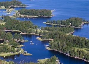
The shallow Kvarken archipelago is the narrowest sound in the Gulf of Bothnia. Part of an UNESCO World Heritage site
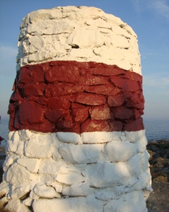
Landmark in the Kvarken Archipelago after two days at sea
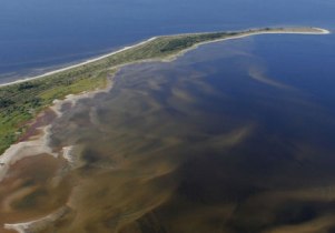
And the sandy reef-like islands of the far North, in the Bay of Haparanda are interesting formations
© Johannes C. Knulst, 2008-2025
From January 2019 this site is upgraded with PHP-version 7.3 and MYSQLi compatibility.
SV Isabell is an excellent long-range sailing vessel for single handed sailing or small family expeditions. Safe, sound, and well built. With a D/L ratio of 342 this 31-foot boat gives a comfortable ride, wherever you sail.
